
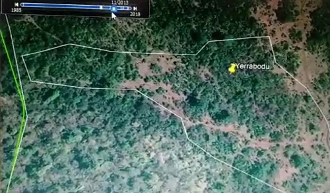
Forest Department officials have photographic evidence based on Cartosat images to support their argument.
Post Date – 11:42 PM, Sat – 11/26/22
Kota Gooden: The state forestry department has produced evidence that the Yerrabodu Gutti Koya residence in the area was recently encroached upon after extensive destruction of forest, most recently with the killing of forestry officer Ch Srinivas Rao.
Forest Department officials have photographic evidence based on Cartosat images to support their argument. District Forest Officer (DFO) Ranjith Naik told Telangana Today in an interview today that images obtained by the department clearly show the presence of dense forests before 2013. The timeline of the images is sufficient to disprove claims by Gutti Koyas and a section of the media that residents of the residence have lived there since 2003. Gutti Koyas in Yerrabodu started podu cultivation only in 2014-15, he said.
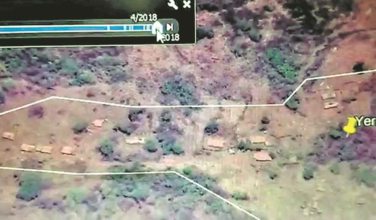
Satellite images show how dense forests existed until 2013, and how over time the greenery started to disappear, in other words, the forest area was gradually destroyed. By 2015-2016, some sheds began to surface, and by 2018, a large dwelling with multiple man-made structures, and a large space without trees appeared. Naik said the Gutti Koya residence belongs to the Bedalapadu gram panchayat of the Chandrugonda mandal, which is part of the Kanakagiri hills.
According to a senior forest official who accompanied DFO (Vigilance) Ramana Reddy to investigate the killing of FRO at the residence, the total area of deforestation was about 35 hectares, of which 15 hectares belonged to Kothagudem sub-division and 20 hectares belonged to Khammam sub-division.
Of the 15 hectares that were deforested, 10 hectares were rehabilitated and plantations developed. Under the Registered Tribes and Other Traditional Forest Residents (RoFR) Act 2006, podu growers will only be issued a certificate of plantation title.
Those who receive the certificate can only cultivate a small piece of land for a living, but they will not become the owners of the land. Title to the land remains with the forestry department, he said.